Faq's, Data and Maps
This page contains information on the Laurel Highlands Snowmobile Club Inc located in Donegal, Pennsylvania.
Have questions about joining the club, rentals or places to stay? See the FAQ for info. Click here
Need a Map ?
North Map above Turnpike and
South Map Below Turnpike
You can print these in small format at home. These are small .jpeg images
Old map
(Snowmobile Club Map) or the New Map (Snowmobile Club
map) .jpeg images (small maps)
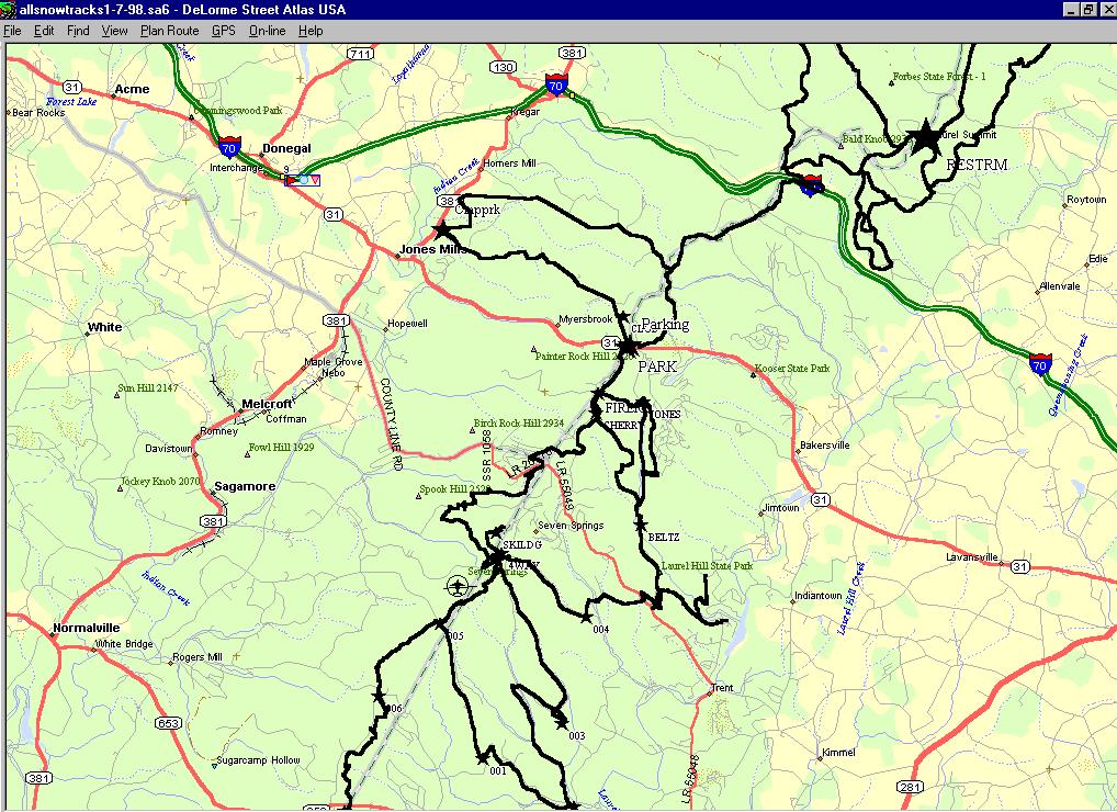
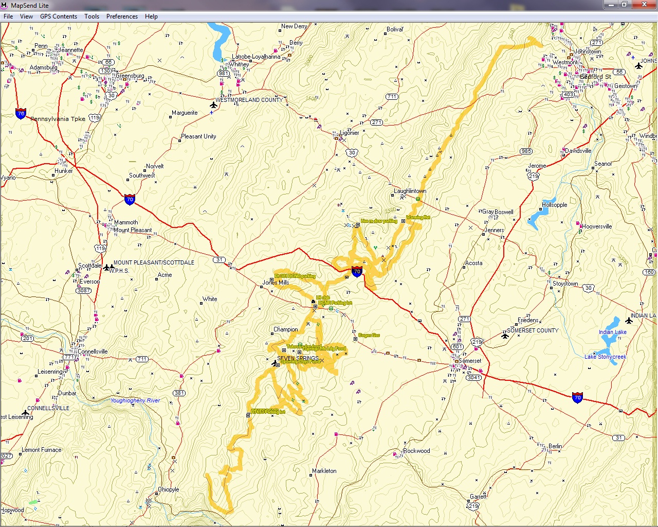
Download GPS DATA for the LH TRAIL SYSTEM !!
Note : To save the GPS file to your computer - Right mouse click on the file name and then do a "save link as". This will save the file to the place shown on the screen. I recommend the desktop as that makes it easy to find. You will need to load Google Earth to view the file or you can upload it to your own software such as Magellans Vantage point, Magellan Map Send Lite, or Garmins software. To open .gpx files you will need to use a program that is compatable with them. There are some converting programs if necessary and Google earth can even do this as well if necessary. The instructions included here are basic instructions for use and if necessary you will need to consult your programs help files as a reference.
Here's what that GPX data looks like on a map. This is produced by Gps4map.